
Trip Data
Duration: April 4–20, 2026; 17 days
Total Miles: 3,105
States Visited: NY · NJ · PA · MD · VA · WV · NC · GA · TN · KY
Longest Day: April 6 - 330.28 miles
Shortest Day: April 12 - 16.43 miles
Notable Roads: The Snake (US-421) · Wya Road · The Tail of the Dragon · Bootlegger 28 · Cherahala Skyway · Route 276 / Pisgah National Forest · Route 28 (La Outa to Franklin) · The Rattler (Route 209) · The Dragon Slayer (Route 160) · The Talon (Route 60) · Highland Scenic Highway (Route 150) · Newfound Gap Road · Foothills Parkway · WV Routes 66, 219, 15, 20, 33
Major Stops: Lexington VA · Asheville NC · Hiawassee GA · Tellico Plains TN · Maggie Valley NC · Cherokee NC · Benham KY · Beckley WV · Marlinton WV · Harrisonburg VA
National Parks: Great Smoky Mountains National Park · New River Gorge National Park
Weather: Perfect spring conditions. Rain on Days 2 and 16
In April 2026, I left New York City on a 17-day, 3,105-mile motorcycle journey south through the Appalachians and back. The ride covered ten states — NY, NJ, PA, MD, VA, WV, NC, GA, TN, and KY — and took me through some of the most celebrated motorcycle roads in the eastern United States, along with a few that most riders have never heard of.
The plan was simple: get south quickly, then slow down and stay awhile. I wanted to spend real time in the Smokies — not a pass-through, but an immersion. Days in Tellico Plains, Maggie Valley, and Cherokee. Multiple runs on the Dragon. The Cherahala Skyway twice. Roads I'd been meaning to return to for years, and roads I'd never found before.
What I didn't plan for was how good the less-famous roads would turn out to be, like Wayah Road in North Carolina, and KY-3418 that went pretty-much nowhere.
I documented the journey in eight field dispatches, published from the road. What follows is the full story — day by day, with every road I rode and what I found along the way.
Watch the Videos
My Route
Itinerary
Days 1–2: New York City to Lexington, VA
Left New York on April 4th via the George Washington Bridge, west on 78, then south on 81. Day 1 ended in Hagerstown, MD — highway miles, heads down. Day 2 started in light drizzle and turned into something else entirely: just north of Staunton, the sky opened up. Hazard lights everywhere, zero visibility. I pulled under a bridge, waited it out, and rode the last 17 miles to Lexington, Virginia instead of Bristol. That was the plan changing itself.
Day 3: Lexington, VA to Wolfin, NC
Finally off the highway. Left Lexington, cut west on Route 21 toward Combers Rock Road, then picked up Route 58 from Volney to Laureldale — a Butler G1 road, sweeping views, tightening turns. From there, US-421 East (the Snake) from Mountain City, Tennessee all the way to just before Bristol. Two highway days and a rainstorm, and then this. 330 miles, 21,843 feet of elevation change.
Day 4: Wolfin, NC to Hiawassee, GA
Stopped in Asheville for a needed oil change. The dealer couldn't take the bike until noon, so the shop suggested a loop: down to Brevard, Route 276 north through Pisgah National Forest, back on the Blue Ridge Parkway. Two hours and absolutely worth it. While waiting at the dealer, a local rider pointed to Route 28 on the wall map. "That's my favorite road. You should ride that." He was right. La Outa to Franklin — technical, tight, signs warning 10–15 mph turns. One of the highlights of the whole trip.
Day 5: Hiawassee, GA to Young Harris, GA
Route 17 south to Helen — steep descent, busy and under construction, but a surreal moment when a military plane flew low overhead against the mountain backdrop. Then a complete contrast: Route 348, the Richard Russell Scenic Byway. Quiet, beautiful, almost entirely empty. US-19 over Blood Mountain, then Route 60 back through Suches, Skeena Gap Road, past Nantahala Lake to Young Harris. Some of the best roads in Georgia.
Day 6: Young Harris, GA to Tellico Plains, TN
Back northeast to Franklin to ride Wayah Road — a road so good I rode it three times. Technical, tight, steep climbs and steep descents. Then Route 129 north to Robbinsville for lunch, and the Cherohala Skyway to Tellico Plains. Two completely different roads back to back in the same afternoon. Wayah Road: close, demanding, unforgiving. The Cherohala: sweeping, open, breathtaking, and 40-plus miles with not a single car in sight. Stayed at the Lodge at Tellico — no crowds, no bar, no restaurant. Just quiet. Exactly right.
Day 7: Tellico Plains, TN — Tail of the Dragon and Robbinsville Loop
Up before sunrise to beat the weekend traffic. Arrived at the Tennessee side of the Dragon at 8am — one vehicle in the past ten minutes, deer on the road, wild turkey on the road. Rode it three times that day. First run: no traffic at all. Third run: a line of Porsches coming the other way. Then Bootlegger 28 to Fontana Dam, Joyce Kilmer and Santeetlah roads back to the Cherahala Skyway, and the 40 miles home to Tellico Plains. 180 miles, 17,000 feet of elevation. A barbecue truck was waiting back in town. Some days just work out.
Day 8: Tellico Plains, TN to Maggie Valley, NC
A detour to Bald River Falls on River Road before picking up the Foothills Parkway into the Great Smoky Mountains. Down to Cades Cove — 20 mph, maybe 10 in practice, and that's the point. Two bears. National Park passport stamped. Laurel Creek Road and Little River Gorge Road running tight and flat alongside the river. Newfound Gap Road, a Butler G1, climbing to 5,046 feet. Third visit to that sign — 2004, 2024, and now. Elk on the descent into Cherokee, reintroduced in 2001 and thriving. Blue Ridge Parkway from Cherokee to Maggie Valley to close the day. 195 miles, 16,000 feet of elevation.
Day 9: Maggie Valley, NC — Wheels Through Time and repositioning to Cherokee
A half-day in Maggie Valley for Dale Walksler's Wheels Through Time Museum — roughly 400 vintage motorcycles, all of them running. Remarkable machines built with limited materials and unlimited ingenuity. That afternoon, a short 16 miles down Route 19 to Cherokee. Not every ride needs to be a mission. Dinner at the casino.
Day 10: Cherokee, NC — Last full day in the Smokies
Left before sunrise. Newfound Gap Road west from Cherokee to Gatlinburg — the sun rising behind, the light hitting the mountains in front, nearly the entire road to myself. And about 20 elk in the fields at the roadside. One made eye contact. Sugarland Visitor Center, Cades Cove loop again (one bear in the distance), Foothills Parkway south, then a detour onto Happy Valley Road — tight switchbacks, steep and close, the complete opposite of the parkway. One final run on the Dragon at midday — busier than Friday but manageable. Lunch at Deal's Gap. The Tree of Shame. If nothing of yours is hanging on that tree, you had a good day.
Day 11: Cherokee, NC to Newport, TN (via the Rattler)
Time to start heading home. Route 19 north through Maggie Valley, then 209 North — pleasant at first, then something else entirely. The Rattler, between Cosby and Hot Springs, is an incredibly twisty pass over the mountain. Both the ascent and the descent earn the name. In Hot Springs, turned onto the Dixie Highway through the river valley to Newport. A western Foothills Parkway section between Denton and Cosby added another G1 road to the day. Smaller, quieter roads working northeast through Cherokee Lake and the Appalachian Highway.
Day 12: Newport, TN to Benham, KY (via the Dragon Slayer)
Routes 391 and 25E northeast through small Tennessee towns. Then Mooresburg to Sneedville to Mulberry Gap — nearly empty roads, beautiful and twisty in a quieter way. Wilderness Road through Jonesville, then 606, a Virginia Scenic Byway through Appalachia, Virginia. Destination: the Dragon Slayer, Route 160 between Appalachia, Virginia and Lynch, Kentucky. Rode it last June in the wrong gear on one critical turn. Came back to fix that. Stayed at the Benham Schoolhouse Inn, reportedly haunted. No ghosts appeared.
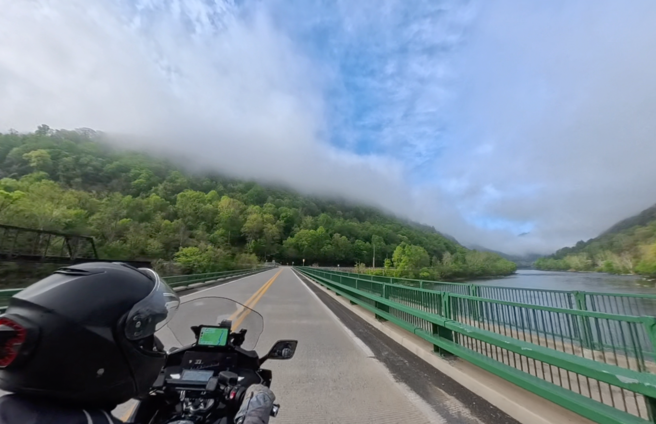
Days 13–14: Benham, KY through West Virginia to Marlinton, WV
Deep coal country. Roads shared with coal trucks and timber rigs — working roads, not tourist roads, and you feel the difference. Day 13 used Rever's twisty routing from Benham to Beckley — delivered beautifully, with one wrinkle: 10 miles of perfect riding on Route 3418, then a road-closed sign a quarter mile from the intersection. 10 miles back. A stranger at lunch in Williamson pointed the way: Route 52 to 97 to 121. Great suggestion. Day 14 opened with a quick run down Route 41 in New River Gorge National Park to the Prince railway station and back. Then across the New River Gorge Bridge, Route 60 west to the Talon — conditions completely different from the June 2025 ride in pouring rain. Clear skies, no traffic, Cathedral Falls walkable at the end. Route 39 through Summersville to Cranberry Mountain Nature Center; the ranger suggested Route 150, the Highland Scenic Highway, right across the street. Completely empty. Met up with 219 south into Marlinton. Stopped at a gas station I remembered from last June — the woman working there remembered me too. Left my map on her window ledge. Stayed at the old Clark Inn. Dinner with two bicyclists, Andrew and Brian. Fourteen consecutive riding days. Time to stop.
Day 15: Marlinton, WV to Harrisonburg, VA
The direct route to Harrisonburg was 97 miles. The actual ride was 263 miles over 5.5 hours. WV-28 North morning sweepers to start. Left on Cass Road, WV-66 — a G1 road over the mountain past Snowshoe Ski Resort. 219 North, another G1, through forest and grassland. WV-15 toward Webster Springs, steady and right-level twisty. Route 20 North to Buckhannon, another G1. US-33 east through Elkins and Seneca Rocks, then a final G1 east into Virginia through the George Washington and Jefferson National Forest — smooth fresh pavement, last ridden under construction in November 2024. Five G1 roads in one day. The descent into Virginia was the last back-roads moment of the trip.
Day 16: Harrisonburg, VA to Allentown, PA
Rain on the hotel windows in the morning. Waited it out in the lobby, got moving at 9:45 with a light drizzle. Interstate 81 north — familiar territory, rode it at least a hundred times. No torrential downpours this time, no planes making emergency landings. Stopped for the night in Allentown rather than push into New York City traffic at the end of a long trip.
Day 17: Allentown, PA to New York City — Home
36 degrees at departure, freeze warnings, warmed up quickly. Timed the Holland Tunnel to avoid morning traffic. Through New Jersey and all the places I grew up, then the first glimpse of the New York City skyline near Newark Airport. Into the tunnel, out the other side, local streets to the apartment. Donette and Finley waiting. Unloaded, parked the bike. 17 days. 3,105 miles. Home.